Detailed imaging of the seafloor used to search for Malaysia Airlines flight MH370 is providing unprecedented insights into the geological development of the Indian Ocean.
IMAS Professor Mike Coffin worked with a Geoscience Australia-led team to analyse data collected for the Australian Transport Safety Bureau-led search by vessels equipped with high-resolution multibeam sonar.
Professor Coffin said little more than 10 per cent of the world’s oceans has been mapped in such detail, mostly near the continents.
“I’ve been working in this part of the Indian Ocean for more than 30 years and have made many voyages to the region, but I have never before seen this level of image resolution,” Prof Coffin said.
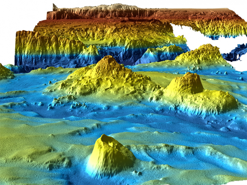
“Indian Ocean seafloor is a complex mosaic that has formed and evolved by a combination of processes, including sea floor spreading, tectonic deformation, and hotspot volcanic activity.
“The latest data allow us to study the impact of these processes in previously unavailable detail.
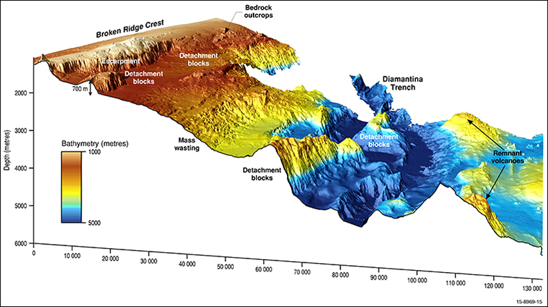 “Along the southern flank of Broken Ridge, for example, we can see more clearly where rifting around 43 million years ago resulted in the seafloor plunging more than 5100 metres from the crest of the ridge to the floor of the Diamantina Trench.
(Multibeam sonar images courtesy Kim Picard and Jonah Sullivan, Geoscience Australia)
“To the north of Broken Ridge the data reveal an area of seafloor erosion, where slides and debris flows have moved sediment down the slopes of a large depression some 90 kilometres in diameter.
“South of Broken Ridge, seafloor spreading created an area of abyssal ridges and fracture zones, the latter up to 900 metres deep and 12 kilometres wide, and lined with volcanic seamounts up to 1500 metres high.
“These new data are already allowing us to better understand the complex events which led to the formation and modification of the seafloor in this part of the Indian Ocean, and we are still only in the early stages of analysing the huge amount of information collected during the search for flight MH370.
“When we look at these data we constantly keep in mind that we wouldn’t have this knowledge but for this terrible tragedy,” Prof Coffin said.
The research – the first geoscientific analysis of the search data - has been published in Eos and is available here.
Institute for Marine and Antarctic Studies
Phone: +61 3 6226 6379
ABN: 30 764 374 782 CRICOS Provider Code: 00586B