Fisheries Research and Development Corporation (FRDC)
The expansion of salmon farming into new growing areas, such as Storm Bay, is contingent on demonstrating that further industry development is done in a responsible and environmentally sustainable way.
Demonstrating best practice in environmental sustainability requires that the footprint of the salmon industry in new areas is well understood and contained within acceptable levels.
As the industry evolves and expands, it is important to ensure environmental monitoring continues to remain fit for purpose, by developing thresholds and indicators of ecosystem health for the surrounding habitats.
To help ensure that salmon farming in Storm Bay is sustainable, this project will develop and implement an environmental monitoring program that assesses the environmental performance of farming at both local and system wide scales.
This project will undertake a suite of sampling techniques to monitor key indicators of environmental change across receiving habitats, as shown in the table below.
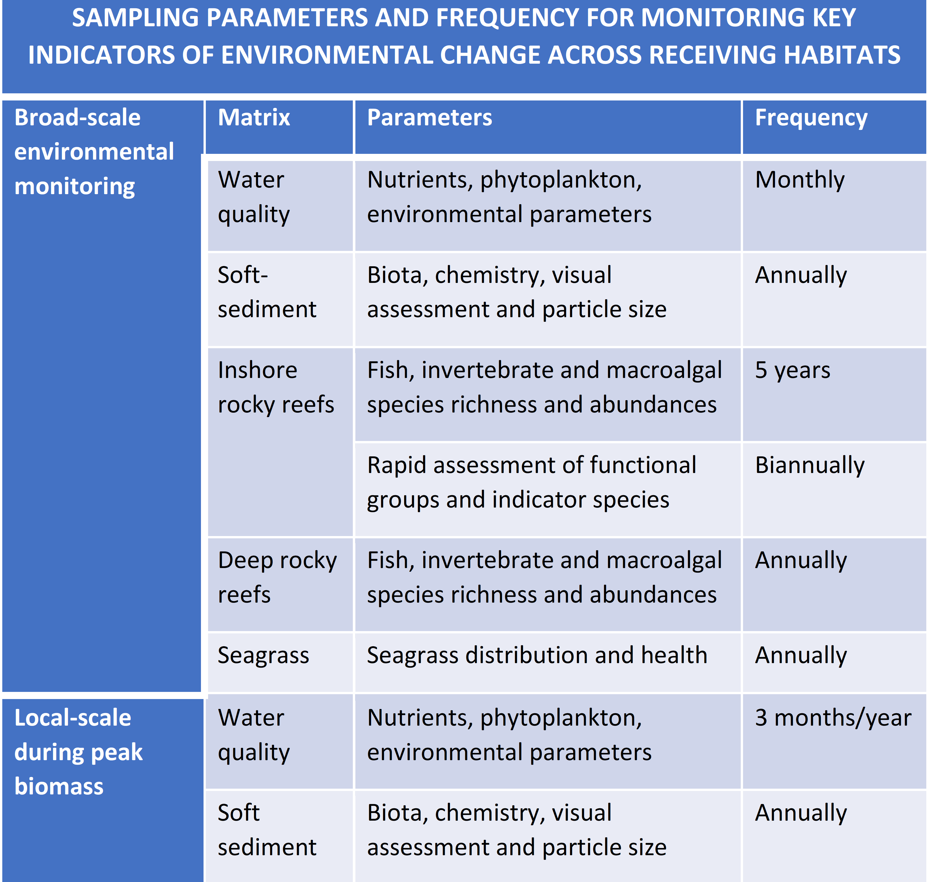 This includes measuring nutrient concentrations and phytoplankton abundance and composition in the water column, the chemical and physical characteristics of bottom sediments and the health of their invertebrate communities, and the health of inshore seagrass beds, rocky reef communities and deep reef habitats (see Images 1-5 below).
The project will also be using multi-beam technology to provide higher resolution and more extensive maps of the key habitats across the whole region (Figure 1). Figure 2 below provides a map of the extent of monitoring to be carried out across the course of the project.
A key output of the monitoring program will be data to assist the calibration and validation of the biogeochemical model that CSIRO are developing for the whole system.
This model will allow the industry and government regulators to make predictions about the effect of different farming inputs on the surrounding environment under varying conditions and with different management scenarios.
We will also be working with CSIRO to develop modelling techniques for simulating and predicting the dispersion of nutrients and sediments at the lease scale (Figure 3).
The combined approach of monitoring, mapping and modelling will provide tools to evaluate the environmental performance of farming at both local and system-wide scales.
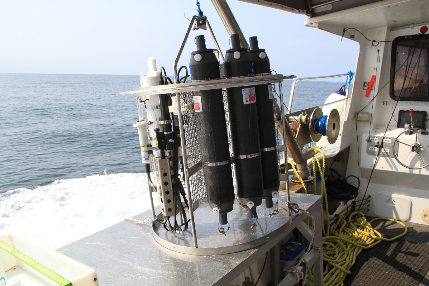 Image 1 (above): Water sampler, the equipment is programmed to collect water from the surface, middle and bottom of the water column. The samples are then processed to determine the amount of nutrients at sites across Storm Bay.
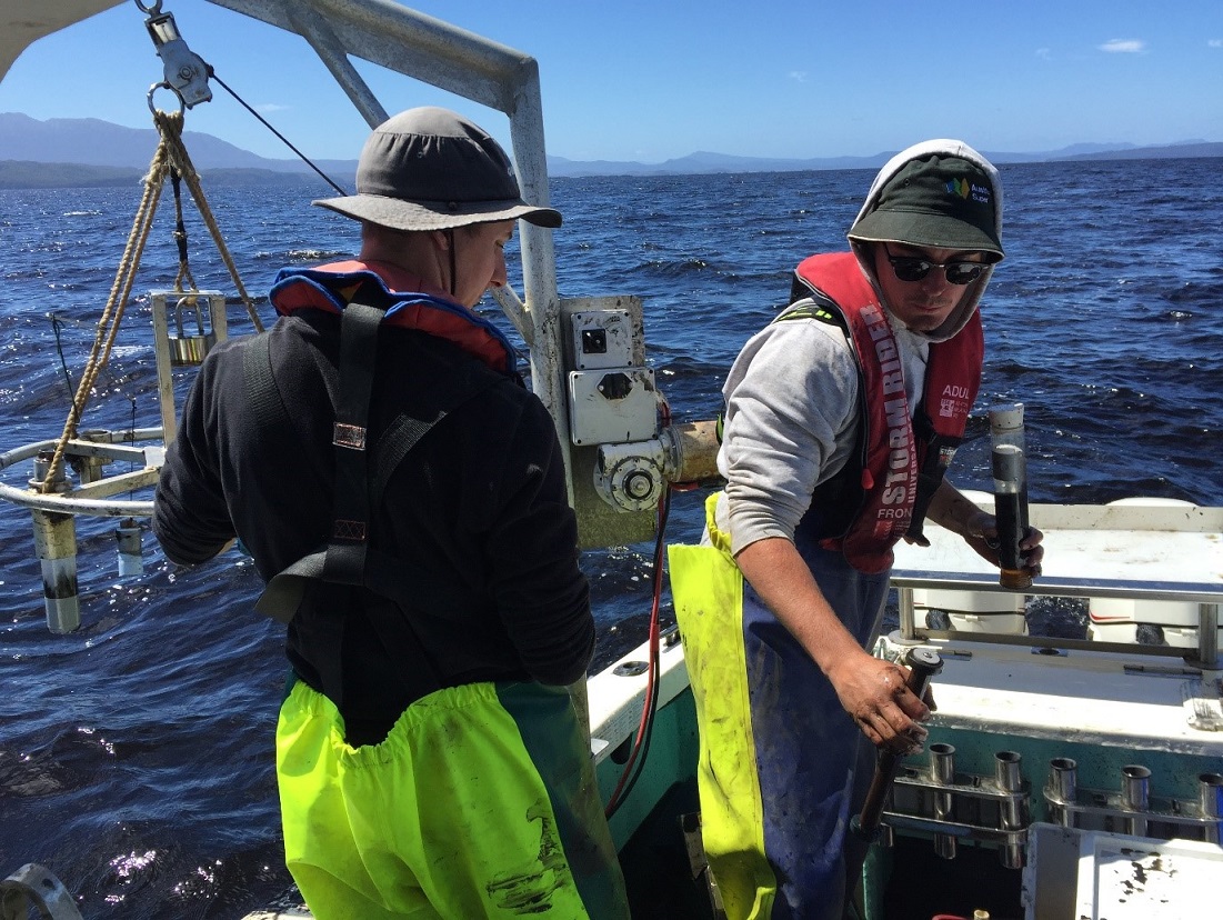 Image 2 (above): Field team retrieving sediment cores. The cores of sediment remain intact and are used for a variety of analysis such as sediment organic content, sulphide and redox levels. Bigger grabs (not shown here) are used to sample the biological communities living in the sediments.
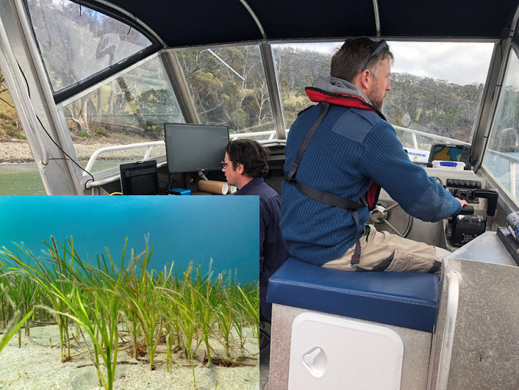 Image 3 (above): Team members capturing remotely operated video (ROV) footage of seagrass. These surveys are used to monitor the extent of the seagrass beds and the condition of deep reefs.
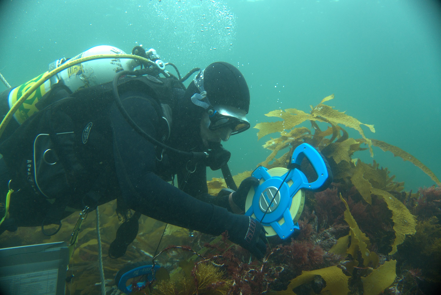
Image 4 (above): Scuba surveys of inshore reefs are used to monitor the abundances and species richness of fish, invertebrates and algae.
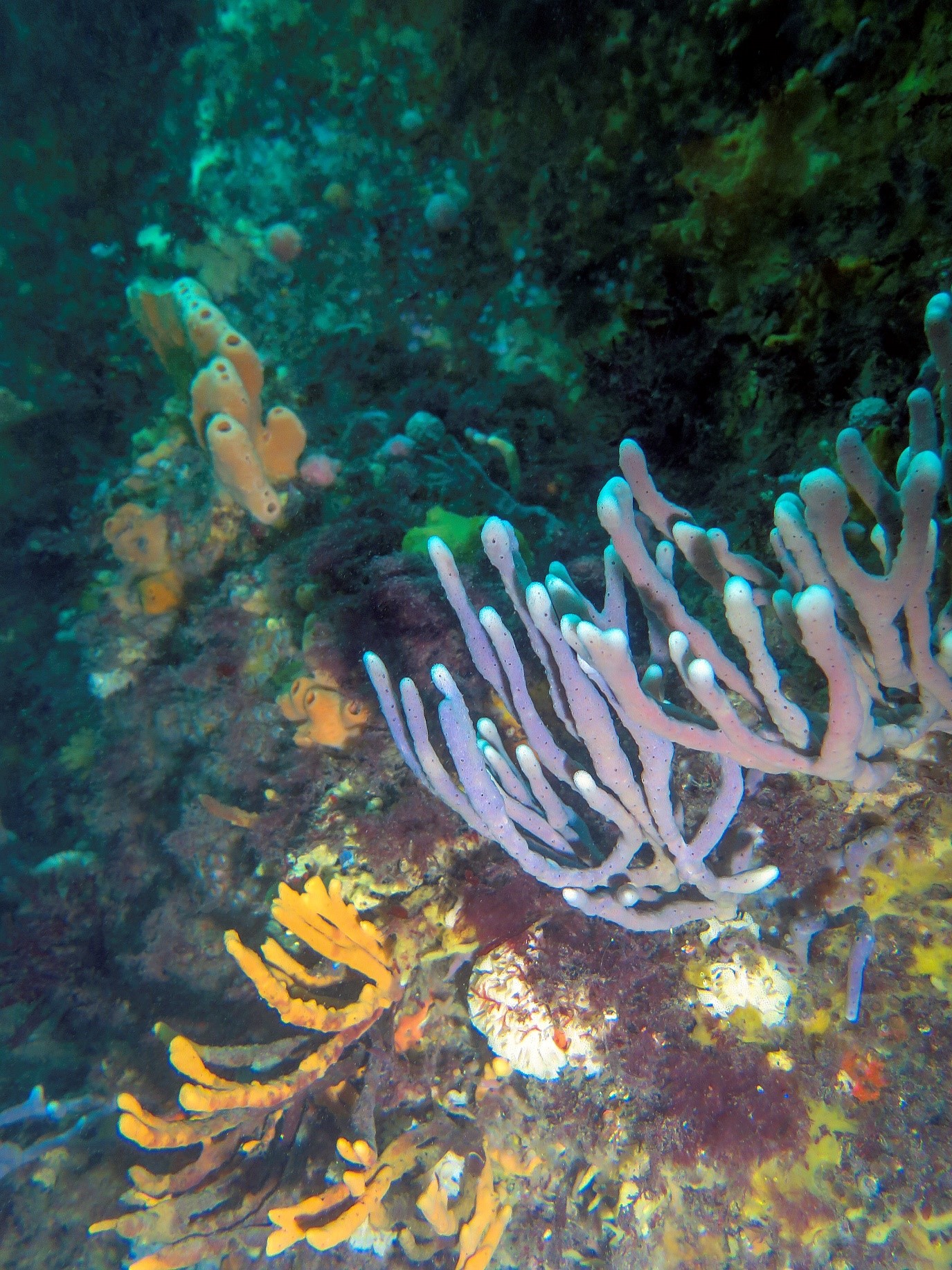 Image 5 (above): The team will monitor the abundance and species richness of fish, invertebrates and algae at deep reef sites across Storm Bay.
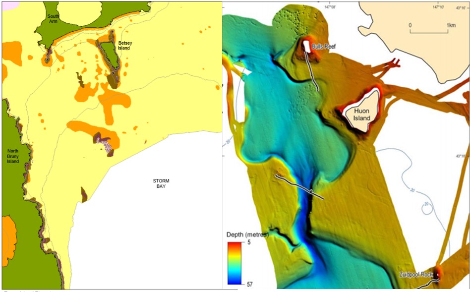 Figure 1 (above): Single-beam (L) and multi-beam (R) echosounder-generated current seafloor habitat maps (see Seamap Tasmania for the full map). The echosounder generated map (right) is of the D’Entrecasteaux Channel adjacent to Storm Bay.The field team will re-visit Storm Bay with a multibeam echosounder to capture full swath coverage of the seafloor. The data will allow us to describe seafloor features more effectively and accurately, including its complexity.
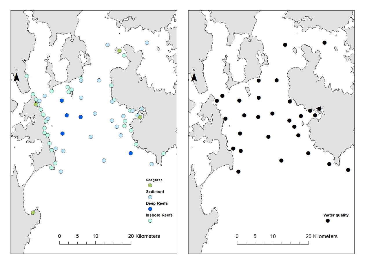
Figure 2 (above): The extent of sites likely to be monitored in Storm Bay during the project.
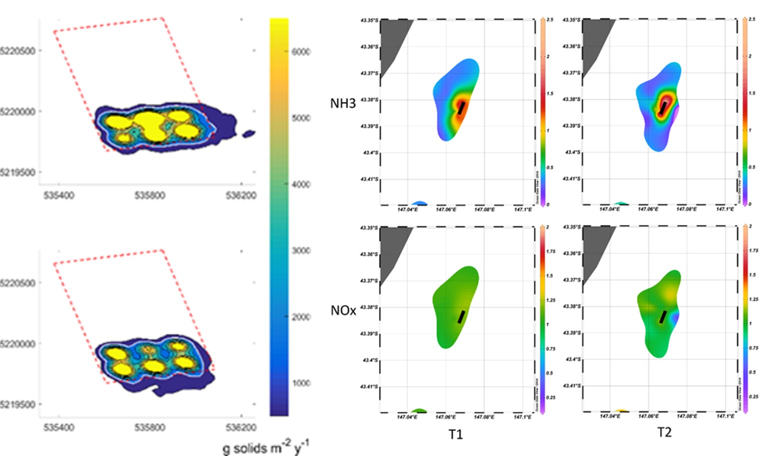
Figure 3 (above): Examples of the sediment footprint of particulates released from salmon cages, predicted using depositional modelling (left) and the water column footprint of dissolved nutrients released via fish excretion. The project will look to further develop the modelling used to predict both dissolved and particulate dispersion from salmon aquaculture, in collaboration with CSIRO.
Interested in this project?
Institute for Marine and Antarctic Studies
Phone: +61 3 6226 6379
ABN: 30 764 374 782 CRICOS Provider Code: 00586B